
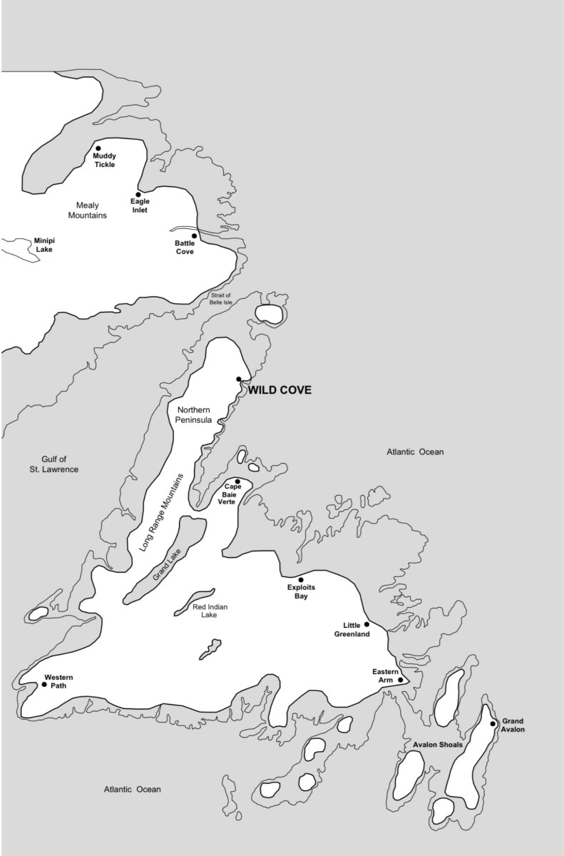
While I was writing my novel The Women of Wild Cove, I visualized what my beloved island of Newfoundland would look like in the year 2203. Following the science of sea level rise—due to melting glaciers, ice sheets, and the thermal expansion of water—I imagined it would appear something like this.
My husband Paul drew the map for me. I wanted it to show the renaming of some communities, and where my fictional Wild Cove is located (there are two other actual Wild Coves in the province). But more importantly, I wanted to show how this large island had shrunk from over 40,000 square miles to nearly half that, with peninsulas reduced to archipelagos, tiny islands and shoals. (By the way, Red Indian Lake had a name change after this map was made. It was changed to Beothuk Lake.)
A friend wondered to me why sea level is rising while many lakes are now showing lower levels. So I asked Google: “Yes, you can have sea level rise and low water levels in lakes simultaneously, because they are different phenomena influenced by different, though sometimes connected, factors. Sea levels are rising globally due to climate change, while individual lake levels fluctuate based on local factors like precipitation, evaporation, snowmelt, and water usage, and can also be impacted indirectly by rising sea levels.”
And of course, science tells us sea level rise is due to human activity.
Have you noticed changes in water levels in your neck of the woods? Do you think there is any possibility of a reversal at this point?

